Groundwater Sustainability
Evaluating how aquifer depletion affects irrigation capacity, crop production, land-use transitions, and long-term agricultural viability.
Research
My research examines how agricultural systems respond to water scarcity, economic constraints, irrigation technology, and land-use change. I combine agricultural economics, hydro-economic modeling, geospatial analysis, and optimization to develop decision-support tools for groundwater-dependent regions.
My work is organized around four connected themes that link water, agriculture, economics, and spatial decision-making.
Evaluating how aquifer depletion affects irrigation capacity, crop production, land-use transitions, and long-term agricultural viability.
Developing economic and optimization models that represent irrigation investment, crop choice, pumping costs, groundwater constraints, and net returns.
Integrating remote sensing, GIS, county-level agricultural data, climate, soil, and water datasets to analyze spatial patterns in agricultural systems.
Building practical tools that help evaluate irrigation technology, water savings, crop transitions, and economic feasibility under changing conditions.
My current work focuses on the U.S. High Plains Aquifer and related groundwater-dependent agricultural regions.
I study how declining groundwater availability may shift irrigated agriculture toward lower-capacity irrigation systems, dryland crop production, and alternative land uses over multi-decade planning horizons.
I evaluate whether perennial bioenergy crops, including switchgrass, can support transitions from water-intensive irrigated systems while contributing to conservation, carbon, and agricultural resilience objectives.
I develop decision-support tools that combine climate, crop yield, soil, slope, energy prices, and investment costs to assess the economic feasibility of irrigation system upgrades.
I am building a field-level dataset of modeled irrigation-system use and application efficiency for irrigated fields across the conterminous U.S., and using it to evaluate the water, energy, and carbon trade-offs of targeted irrigation system upgrades.
Coupled hydro-economic and MODFLOW groundwater-flow modeling of the Ogallala Aquifer to quantify how hydrogeologic leakage limits decentralized conservation, and how the scale of collective pumping management can recover conserved water.
County-scale results from the 30-year hydro-economic simulation of the U.S. High Plains Aquifer published in Agricultural Water Management (2026).
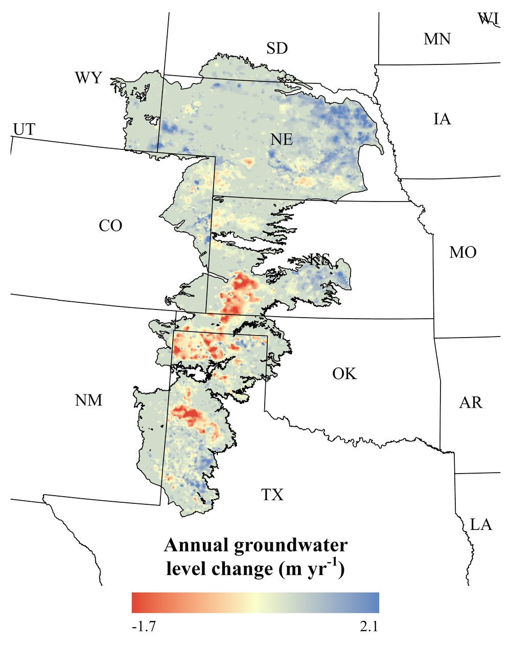
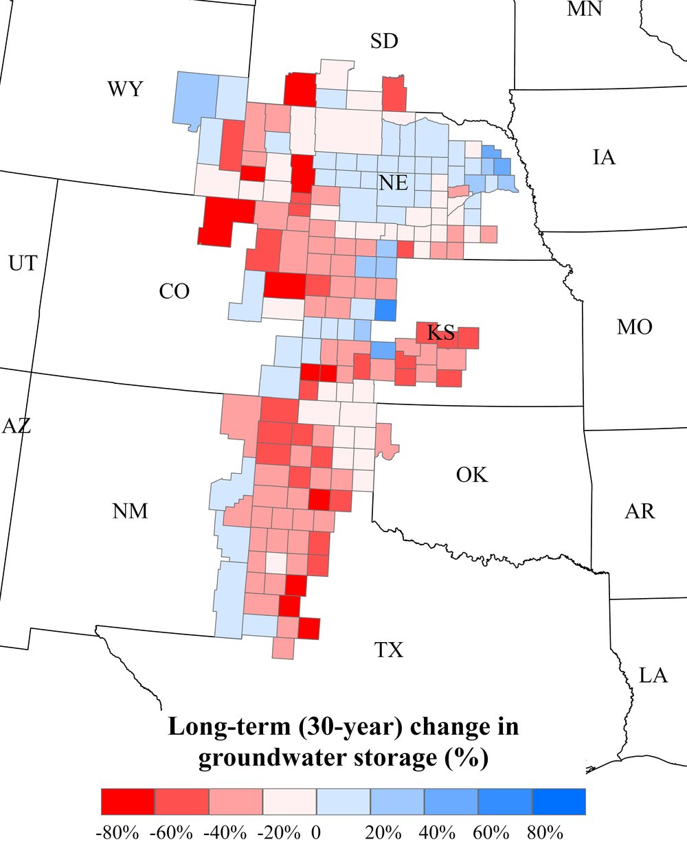
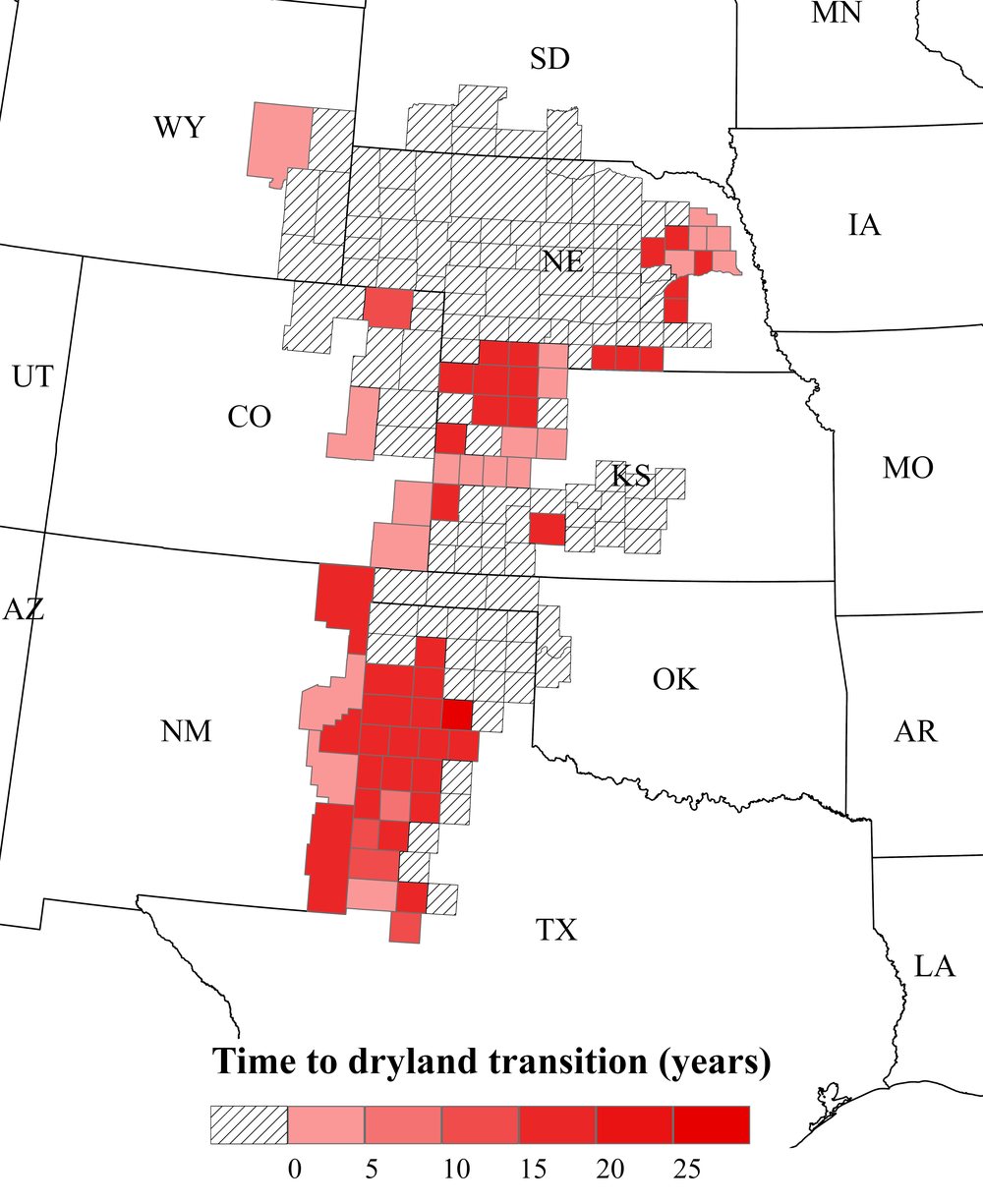
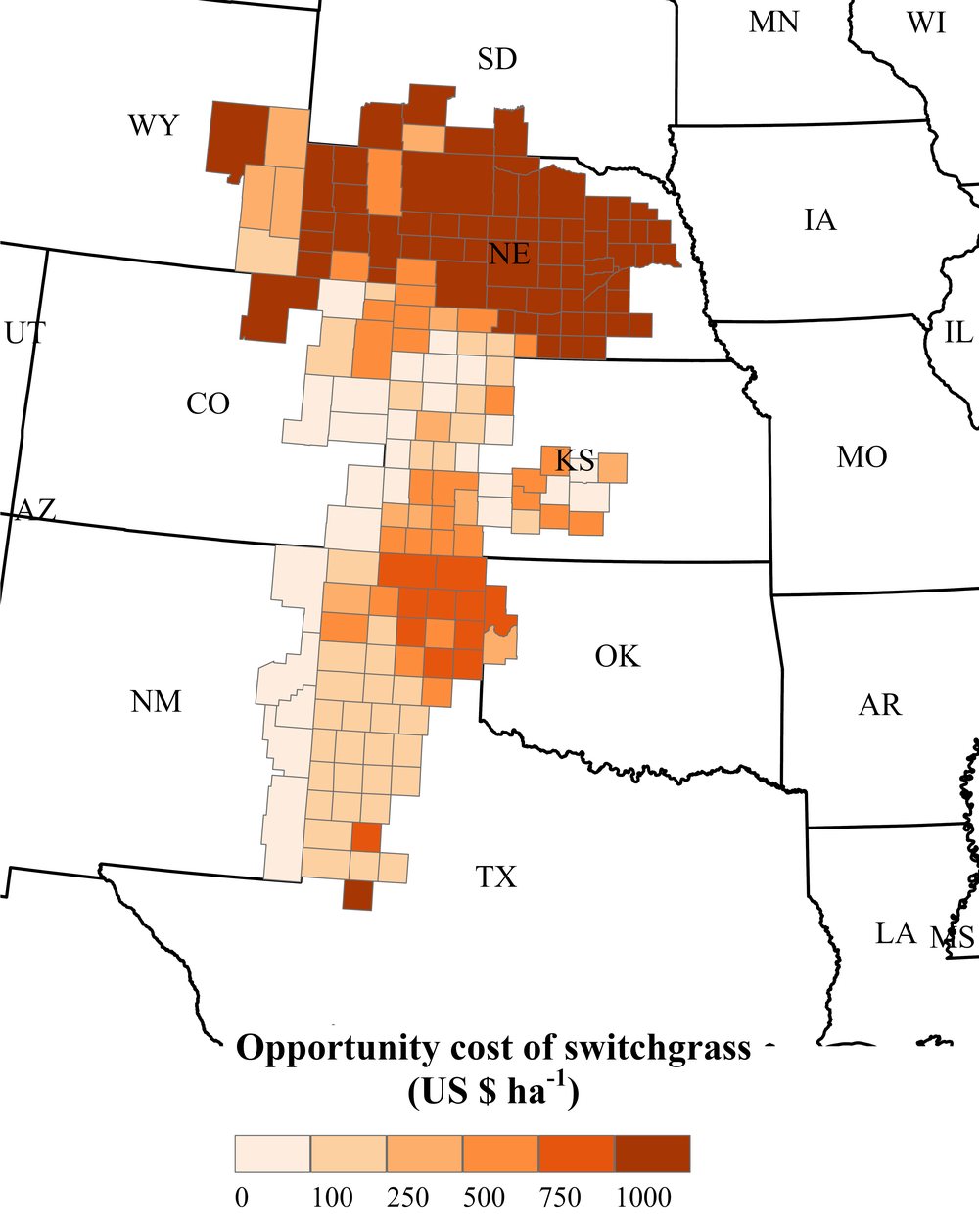
Figures from Ramaswamy, Uludere-Aragon, and Lark (2026), Agricultural Water Management 334, 110675 (open access, CC BY). Click a map to view it at full size.
My research uses a combination of economic modeling, spatial analysis, optimization, and agricultural datasets.
I welcome inquiries related to agricultural water management, groundwater sustainability, irrigation economics, land-use transitions, and decision-support modeling.